CNRS launches observation campaign of seismic activity in Mayotte
Earth
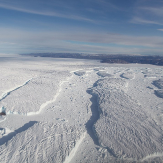
Since May 10, 2018, multiple earthquakes have been reported off the island of Mayotte (Indian Ocean), some of which were widely felt by the population. The data collected so far suggest that the process is a combination of seismic and submarine volcanic activity. From 23 February 2019, a number of land and sea-based missions coordinated by the CNRS, with the support of the French Geological Survey (BRGM), the Paris Institute of Earth Physics (IPGP), the French National Geographic Institute (IGN), the French marine research institute IFREMER, and the French Ministry for Ecological and Inclusive Transition, will attempt to shed light on the underlying mechanisms involved, which will make it possible to better assess the potential impacts.
For the past nine months, Mayotte has been experiencing sustained seismic activity. Despite relatively poor seismological coverage due to the moderate seismicity of the region, monitoring was carried out by the BRGM from three seismic stations located on the island, supplemented by other more distant regional stations, in particular in the Comoros and Madagascar. The analyses carried out by the BRGM, IPGP, the School and Observatory of Earth Sciences (CNRS/University of Strasbourg) and the Karthala Volcano Observatory (CNDRS1 , Grande Comore) have already led to improved interpretation of seismic signals.
Over 1600 earthquakes2 , located 50 km east of Mayotte, have now been recorded. Among them, 29 events with a magnitude in excess of 5 were widely felt by the population of the archipelago and, in some places, impacted buildings. In addition, low-frequency signals of a different kind, which travel more easily over long distances, were recorded by global networks, particularly on 11 November 2018. These signals may correspond to imperceptible tremor-type seismic events, which are caused by rising magma. In addition, since July 2018, regular measurements carried out by the permanent GNSS3 network at the IGN show that the six high-precision GPS stations installed on the island of Mayotte have recorded a continuous eastward shift of approximately 14 mm/month, combined with subsidence of 7 mm/month. All these data suggest that this current episode could be of the seismo-volcanic type.
A scientific call for tenders to characterize seismo-volcanic processes
At the BRGM's initiative, right from the beginning of the seismo-volcanic episode the scientific community swung into action with the aim of understanding the processes taking place and their development. In this context, the CNRS coordinated a call for tenders, co-financed by the Ministry for Ecological and Inclusive Transition. Addressed on 29 November 2018 to over 20 French research laboratories working in this field, the objective is to improve the observation and scientific understanding of these processes and to better estimate the potential hazards and impacts for this French territory. With a budget of 420,000 euros, it will support observation missions by deploying instruments on land and at sea, the data from which will have to be made available to the scientific community as rapidly as possible. The call for tenders also includes the analysis of these data and the development of the observation network.
After evaluating the proposals received by the Scientific and Operational Committees, three projects were selected by the Steering Committee on 22 January 2019. The projects involve 11 laboratories and 44 researchers, academics, engineers and technicians from the CNRS, IPGP, BRGM, IFREMER and IGN.
On land and at sea: a major deployment of instruments from late February to summer 2019
- Deployment of ocean-bottom seismometers. From 23 to 27 February 2019, a team from the Paris Institute of Earth Physics (CNRS/IPGP/Université Paris Diderot) will deploy six ocean-bottom seismometers from the CNRS-IPGP pool associated with a pressure sensor, using the SGTM cargo ship Ylang. The deployment is planned to last six months.
- Deployment of instruments in Mayotte. A team from the School and Observatory of Earth Sciences (CNRS/University of Strasbourg) will travel to Mayotte in the week of 4-8 March 2019 to install high-precision seismic and GNSS3 stations on the sites of the municipalities of Mtsamboro (northern Grande-Terre), Kani-Kéli (southern Grande-Terre) and Pamandzi (Petite-Terre). The deployment is being carried out with the support of BRGM teams in Mayotte and Orléans, together with support from the IGN for the retrieval and dissemination of GNSS data.
- Installation of a new geophysical station in the Iles Glorieuses. The Piton de la Fournaise Volcano Observatory (OVPF-IPGP) has scheduled a reconnaissance of this uninhabited archipelago located between the Comoros and Madagascar, followed by the installation of a seismic station on 13 and 14 March 2019 during an army rotation. A second operation to install remote transmission and a high-precision GNSS station is planned for April 2019.
An oceanographic campaign is under discussion with IFREMER and the French Ministry for Ecological and Inclusive Transition and Ministry for Higher Education, Research and Innovation, with the aim of surveying the seafloor, as well as detecting and quantifying possible degassing associated with a submarine volcano. This may take place in the spring or summer of 2019.
In addition to the deployment of instruments, a team from the University of Reunion, partner of the OVPF-IPGP, will carry out fieldwork to consolidate knowledge about the tectonic and volcanic history of Mayotte, based on the identification of the island's tectonic structures, dating of igneous rocks, and analysis of ground gas composition. The various teams in the field will analyse the data and carry out modelling. The IGN’s permanent GNSS network team will focus on retrieving and disseminating all the GNSS data to the entire community.
Contact
Eric Humler
CNRS coordinator of the TelluS-Mayotte call for tenders