Mission to monitor seafloor fault at foot of Mount Etna
Earth
|
|
Scientists from the CNRS, IFREMER, and Université de Bretagne Occidentale (UBO), together with their German and Italian colleagues, are getting ready to embark on the FocusX3 mission, to last from 17 to 27 February 2023, off the Sicilian coast. Their goal is to study a seafloor fault more than 2,000 m under the water, at the foot of Mount Etna, and to further understand the movement of water at these depths.
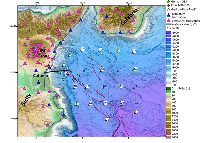
Southern Italy has already been sorely tried by volcanic and seismic activity: earthquakes claimed 40,000 lives in 1693, and 72,000 in 1908. Among the suspected culprits is the North Alfeo Fault, 2,100 m under the surface of the Ionian Sea and roughly 20 km from the Sicilian city of Catania, in an area home to one million.
To acquire a firmer understanding of the fault system—which stretches over 100 km, from the coast at the foot of Mount Etna on to the southeast—scientists from the CNRS, IFREMER, and UBO,1 alongside their German and Italian colleagues,2 completed two earlier Focus missions3 off of Sicily, aboard ships of the French oceanographic fleet.
The researchers deployed a 6-km fibre-optic cable that measures fault movements with laser interferometry. They have sought to demonstrate how this technology—capable of detecting submillimetre displacements, and commonly used to monitor major infrastructures like bridges and dams—can also be applied, for the first time ever, within the environmental conditions of seafloor faults. A network of 29 ocean-bottom seismometers has made it possible to check the measurements made with the fibre-optic cable.
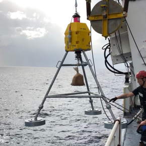
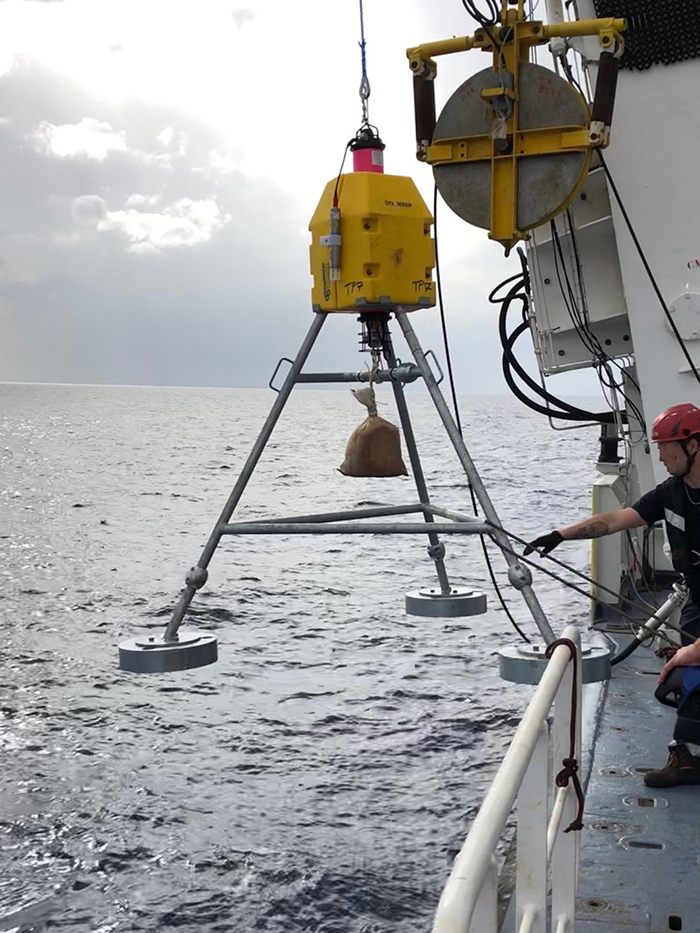
During the FocusX3 mission, which will run from 17 to 27 February 2023, the research crew will be recovering all of the seismometers and then redeploying half of them for 6 to 12 months. Other instruments, including 13 seafloor geodetic stations, will be positioned to measure the relative displacement of tectonic blocks on either side of the fault.4
Finally, a seafloor current-meter station will make its debut at the site, to collect data in hopes of explaining an astonishing observation: over the last years, the cable interferometric system has detected displacements not picked up by the geodetic stations. From this fact, the research team has deduced the presence of hitherto-unknown movements of deep waters, which must be studied if this finding is to be explained.
Should this hi-tech underwater instrumentation off of Sicily prove effective, the potential for harnessing global networks of telecommunications cables to study and better quantify seafloor tectonic movements may be considered.
© Marc-André Gutscher / Geo-Ocean / Focus
© Marc-André Gutscher / Geo-Ocean / Focus
- 1All work at the Geo-Ocean (CNRS / IFREMER / UBO) laboratory, part of the European Institute for Marine Studies (CNRS / IRD / UBO).
- 2These researchers hail from the GEOMAR institute, in Germany; and from the Istituto Nazionale di Geofisica e Vulcanologia, Università di Catania, and Laboratori Nazionali del Sud (part of the Istituto Nazionale di Fisica Nucleare), in Italy.
- 3Focus is a European project funded through a €3.5-million European Research Council Advanced Grant.
- 4The seafloor geodetic station network will include 8 French (Exail, Brest) and 5 German (GEOMAR, Kiel) units that will provide data on relative displacements due to tectonic activity along the fault.